Vacant Land
$130,000
St. Philip's · MLS® #1296112
1140-Lot 3 Thorburn Road
213 days on market
Listed by RE/MAX Realty SpecialistsGary Cole
—
Active Listings
—
Avg. Home Price
—
Avg. Days on Market
—
NL Communities
Loading current MLS® properties…
MLS® #1305507Listed November 16, 2026
St. Philip's
$125,000
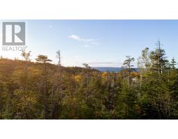
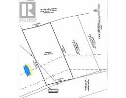
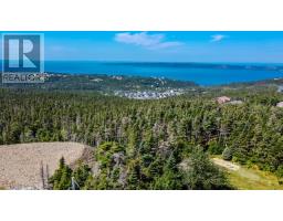
An approximate 1/2-acre approved residential building lot situated on Tucker's Hill, St. Philips with privacy and potential for Broad Cove Valley, Sunset and Bay views. Strategic and interesting treed homesite maintaining 224' road frontage. Centerline of driveway has been cut for purposes of illustrating optimum driveway placement straddling hillside contours and to access site location to commence new home development. (id:66441)
Cost To Own
Homes in a hot market often sell over asking. Model your winning bid, then adjust the financing to see the real cash to close and monthly carrying cost — including default insurance when you put down under 20%.
$125,000
Amortization
Add your monthly carrying costs
Enter property-specific figures when known. They start at zero because they are not supplied reliably for every listing.
Estimated Monthly Mortgage
$596
Cash To Close
$25,000
Estimate only — final costs depend on lender approval, taxes, insurance, and closing costs.
Contact Felix
Speak with Felix about showing times, offer strategy, financing next steps, or whether this property fits your search.
Similar Listings
St. Philip's · MLS® #1296112
213 days on market
Listed by RE/MAX Realty SpecialistsGary Cole

St. Philip's · MLS® #1296111
213 days on market
Listed by RE/MAX Realty SpecialistsGary Cole
St. Philip's · MLS® #1294170
291 days on market
Listed by Royal LePage Atlantic HomesteadHeather Guy

Request More Information
Ask about this home
Elementary Schools
Beachy Cove Elementary
PublicBrookside Intermediate
PublicHoly Family Elementary
PublicSecondary Schools
Brookside Intermediate
PublicHoly Spirit High
PublicFirst Baptist Academy
PrivateStraight-line distance from this property. Proximity does not determine enrolment — confirm catchment areas with the Newfoundland and Labrador English School District. School list and grade levels from Statistics Canada's Open Database of Educational Facilities; some locations from OpenStreetMap contributors.
Straight-line distance from this property. Healthcare locations from Statistics Canada's Open Database of Healthcare Facilities; shops, pharmacies and filling stations from OpenStreetMap contributors.